Quick Data
MCDC Data Applications
Population
- State/county annual population change, 2000–2017
- State/county population trends, with demographics
- Population estimates by age, with demographics, 1990–2017
American Community Survey
Decennial Census
Geographic
- Data sources by area
- GeoID lookup & population
- ZIP code lookup & basic data
- Circular area profiles
- Geocorr geographic correspondence engine
Economic
U.S. Census Bureau Applications
Featured Articles
Welcome to the Missouri Census Data Center
The Missouri Census Data Center (MCDC) is a cooperative program among state agencies in Missouri and the U.S. Bureau of the Census. Its purpose is to enhance awareness of and access to public data, especially Census Bureau products.
The MCDC data archive, which includes many national collections as well as Missouri-specific data, is one of the premier sites in the country for accessing census and other public, machine-readable demographic and geographic data. Data may be accessed directly, via the public machine readable data archive, or by using one of the custom applications.
Email us directly for questions about census data or any of MCDC's data or applications.
MCDC News and Data Updates
The Physiographic Regions of Missouri
The state of Missouri boasts a diverse natural landscape, including vast forests, rolling plains, sprawling river systems, highlands, and swamps. In this month’s story map, MCDC’s partners at the Missouri Spatial Data Information Service (MSDIS) classify these natural features into regions and compare their boundaries to census data provided by MCDC. Missouri Census Data Center […]
Missouri County-Level Health Factors
The Missouri Public Health Management System (MOPHIMS) County-Level Study surveys approximately 50,000 Missouri residents to estimate health-related measures throughout the state. Questionnaires gauge behavioral risk factors related to health and document participants’ reports of chronic disease diagnoses. This month, MCDC’s partners at the Missouri Spatial Data Information Service (MSDIS) present county-level maps showing results of […]
Missouri Unemployment Rates, 2020-2021
This December, our partners at the Missouri Spatial Data Information Service (MSDIS) present a swipe map comparing unemployment rates in Missouri counties during the years 2020 and 2021. This is a follow-up to the previous MSDIS map comparing Missouri county unemployment between 2000 to 2020. The left side of the swipe map shows unemployment by […]
Geocorr and Other Application Updates (December 2023)
MCDC has a number of significant application updates to announce this month. We added several new geography types to the Geocorr 2022 application, including the new core-based statistical areas (CBSAs, which include metropolitan and micropolitan statistical areas), metropolitan divisions, and combined statistical areas (CSAs), all of which were released by the Office of Management and […]
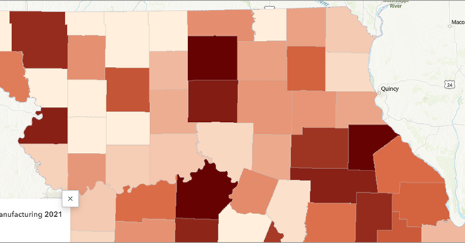
Manufacturing Employment in Missouri over the Past Decade
The manufacturing sector is the fifth largest employer in the United States and the third largest in Missouri (after health care and retail trade). This month, our partners at the Missouri Spatial Data Information Service (MSDIS) examine how manufacturing employment has changed in Missouri counties between 2011 and 2021 using County Business Patterns data from […]


